LANDSCAPES AND RURAL AREAS – LANDSCAPE BIOGRAPHIES AND NARRATIVES
WHAT DOES STEENHUISMEURS DO?
SteenhuisMeurs produces a great number of landscape biographies and narratives. Stories about the landscape and the people, about the use of the soil and the emergence of mentality. These are stories that provide interpretation, comfort and frequently also a mirror; in previous generations, too, there were major challenges, a search for solutions. The biographies and narratives are always based on archive research and a multitude of sources, ranging from the National Archives to the Meertens Institute, from the Central Bureau of Statistics to thematic discussion salons in the area concerned. The focus is always on critical interpretation, assignment analysis and recommendations for further development. Because every area has a different degree of urbanisation pressure, different landscape types and consequently a different loading capacity for new developments.
CASE 1
ARTIS AMSTERDAM ROYAL ZOO
Cultural heritage assessment and Quality Team
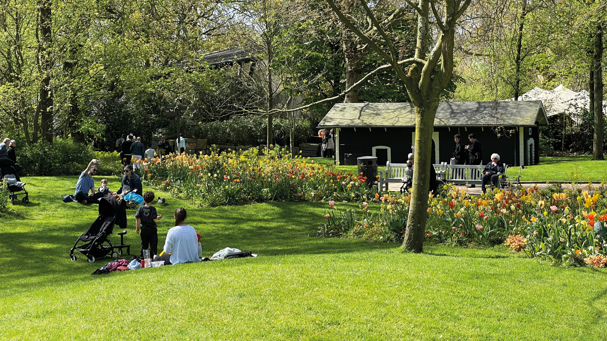
On behalf of SteenhuisMeurs, Marinke is a member of the Quality Team of Artis. If there is one place where the term palimpsest (a rewritable piece of parchment) applies, it is Artis. Ever since its establishment in 1838, amidst former country houses, the zoological garden has been in almost continuous transformation. This unique layering of time and the sequential landscaping concepts were not properly researched. A better understanding of the historical development provides a framework and inspiration for the many changes that Artis is continuously going through. The Amsterdam City Archives preserves the majority of the Artis archive, but the zoo itself also holds a substantial amount of undocumented papers and drawings, spread out over several of its buildings. For every section of the zoo, these documents are now brought together, resulting in a fascinating illustrated storyline of almost 200 years of Amsterdam history.

The central axis of ARTIS
CASE 2
ALMERE PAMPUS
Landscape biography
commissioned by the Municipality of Almere and the Central Government Real Estate Agency
Should the IJmeer connection between Amsterdam and Almere be built, it would land at Almere Pampus. Currently, the area is a polder and woodland, with recreational routes and land art projects. While awaiting a decision, Almere and the national government are preparing plans for a new city district. How can existing structures and the broader story of Almere be incorporated?
To inspire the planning process and map the cultural heritage, SteenhuisMeurs drafted the landscape biography of Almere Pampus. The study built on earlier projects, such as the landscape narrative of the Amsterdam Metropolitan Region and The Lived City (2020), which examined Almere’s identity. The biography included the regional context of Almere Pampus as a water and coastal landscape, as well as the history of previous plans for the area. The result: a visualisation of heritage and landscape values and definition of starting points for future development.
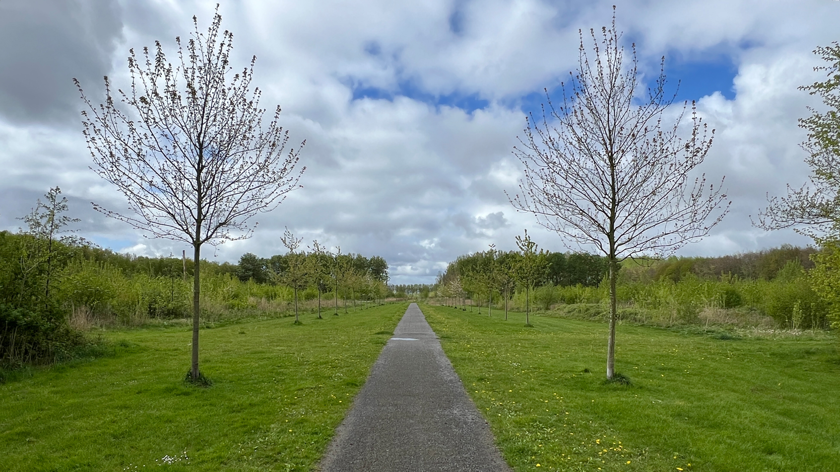
Long views through Pampushout
CASE 3
ENSCHEDE IN EIGHT TRANSFORMATIONS
Landscape biography
commissioned by Bestuurlijk Platform Groene Hart
Enschede is a city that continually reinvents itself. Its biography is told through the rhythm of eight transformations. The study concludes with eight lessons from history that shaped the city and can guide its future. The narrative was presented to residents during Open Monuments Day 2025 in the Kleine Willem theatre, marking the 700th anniversary of Enschede.
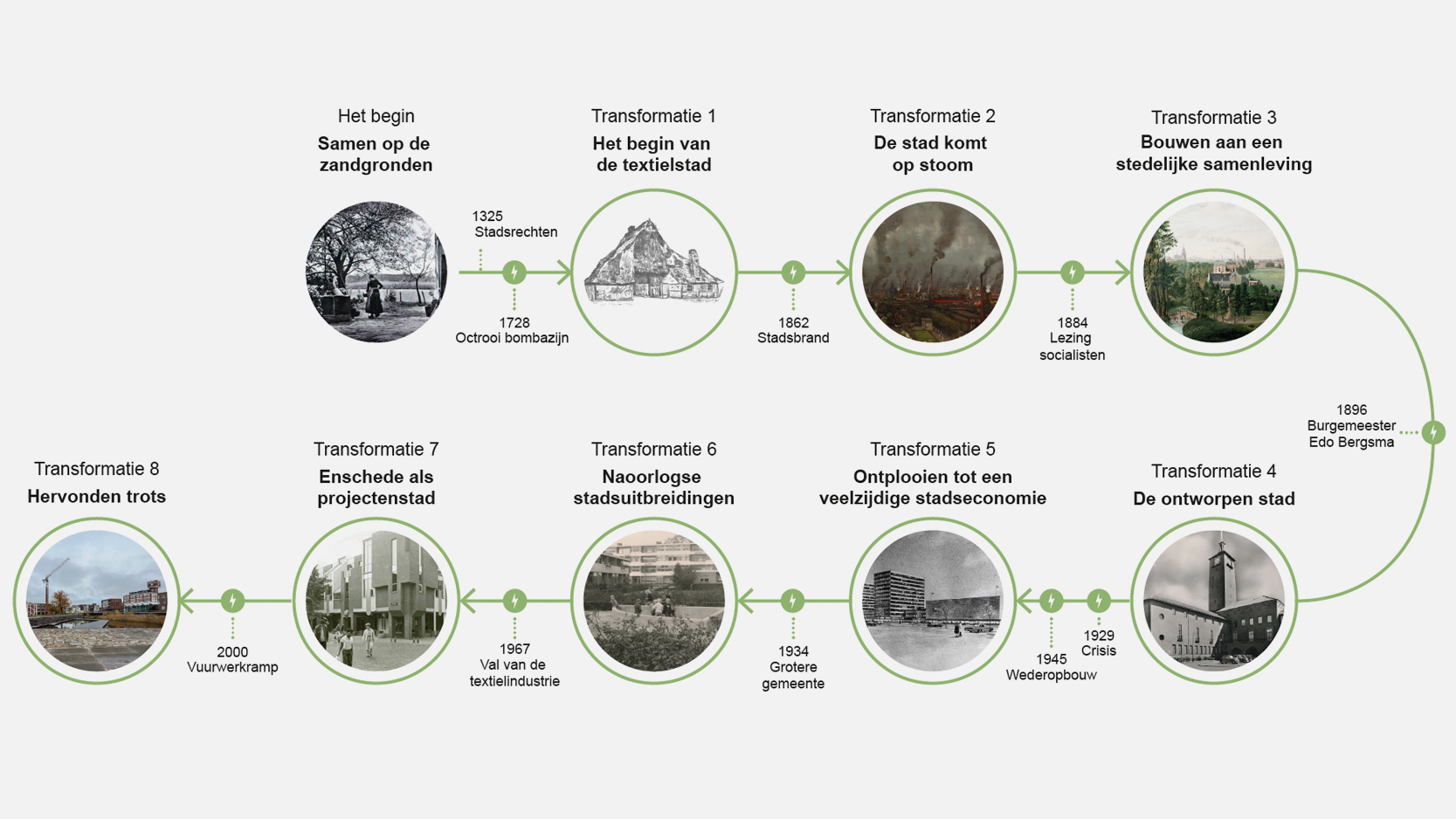
The timeline of Enschede in eight transformations
CASE 4
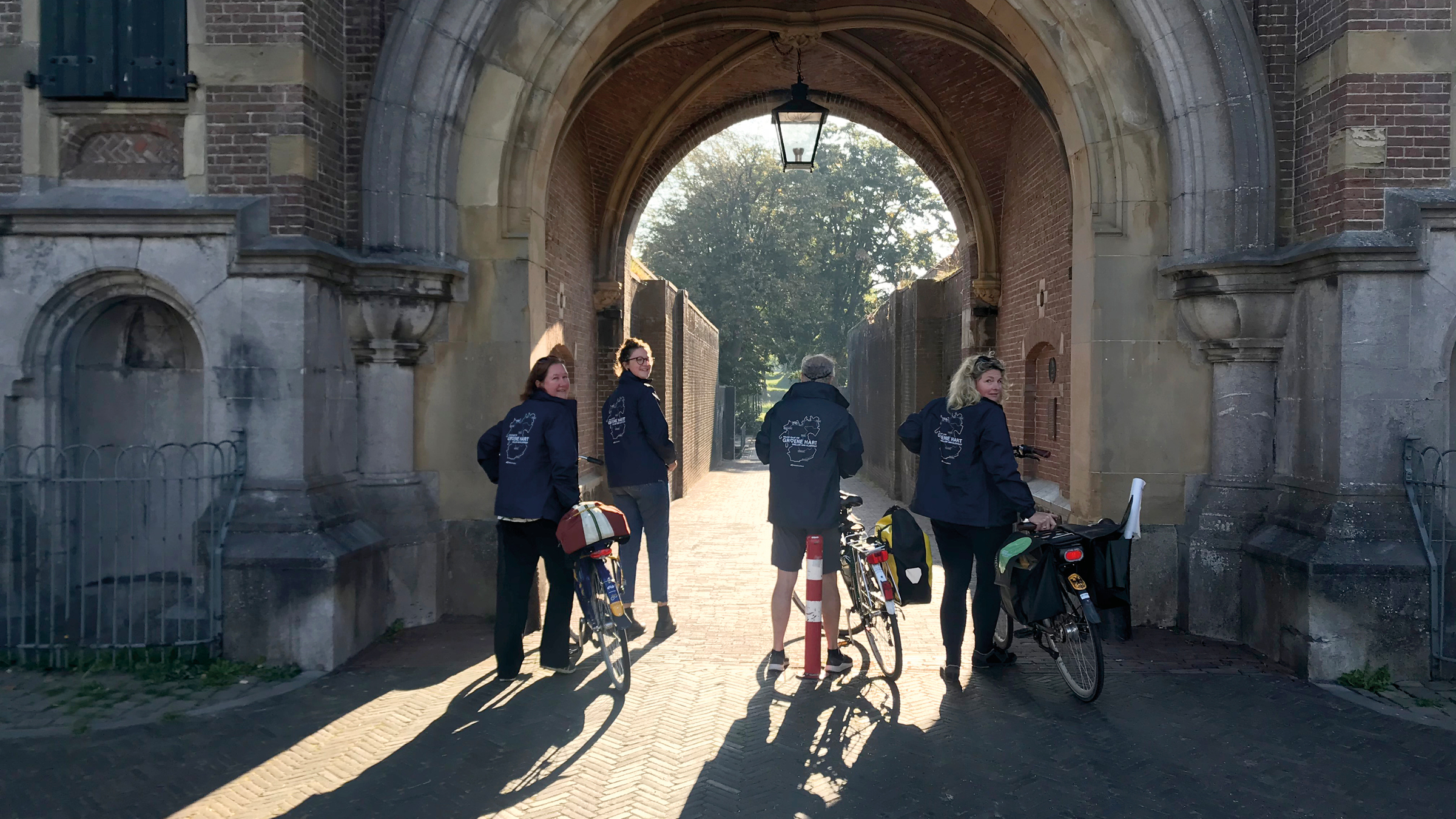
THE GREEN HEART
Landscape biography
commissioned by Bestuurlijk Platform Groene Hart
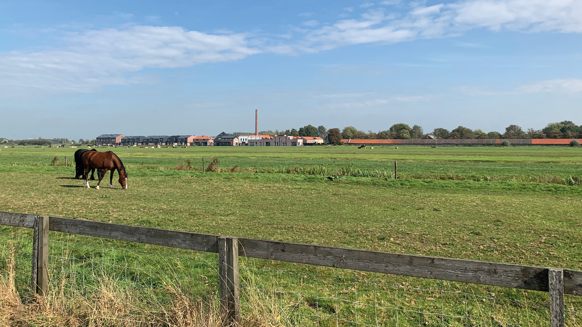
Since 2021, the Green Heart between Amsterdam, Rotterdam and Utrecht has been a focal area in the National Strategy on Spatial Planning and the Environment (NOVI). Many challenges which require consideration on the scale of the Green Heart come together in a dynamic process: land subsidence, urbanisation, nitrogen emissions, soil salinity, solar and wind energy and – more widely – the quality of the Dutch living environment. These are issues that cannot be solved sectorially. They require a combined and balanced approach. In order to make decisions on both a political and an administrative level, there is a need for more knowledge, contextualisation and overall direction. The landscape biography of the Green Heart supports this process. It consists of three parts. A connecting story from a cultural heritage perspective, from the long lines of the past to the present and the future, helps as a first step in bringing the shared interests in the Green Heart together. Without a story, ‘landscape’ remains abstract and lacks connection to the greater whole. Without a family line, mutual interests cannot be comprehended. In part 2, the cultural heritage values of the Green Heart landscape are identified in a heritage assessment map. In part 3, golden rules for the further development of the spatial qualities of the Green Heart are formulated. The landscape biography functions as a starting point for the rising challenges. In five online films, the landscape biographies of the Green Heart and its three subsections are told and the heritage assessment map is explained. In 2023, we published the book The Green Heart. World in between cities, which can be ordered here: hetgroenehartboek.nl

The Green Heart
LANDSCAPES AND RURAL AREAS – LANDSCAPE BIOGRAPHIES AND NARRATIVES
WHAT DOES STEENHUISMEURS DO?
SteenhuisMeurs produces a great number of landscape biographies and narratives. Stories about the landscape and the people, about the use of the soil and the emergence of mentality. These are stories that provide interpretation, comfort and frequently also a mirror; in previous generations, too, there were major challenges, a search for solutions. The biographies and narratives are always based on archive research and a multitude of sources, ranging from the National Archives to the Meertens Institute, from the Central Bureau of Statistics to thematic discussion salons in the area concerned. The focus is always on critical interpretation, assignment analysis and recommendations for further development. Because every area has a different degree of urbanisation pressure, different landscape types and consequently a different loading capacity for new developments.
CASE 1
ARTIS AMSTERDAM ROYAL ZOO
Cultural heritage assessment and Quality Team
On behalf of SteenhuisMeurs, Marinke is a member of the Quality Team of Artis. If there is one place where the term palimpsest (a rewritable piece of parchment) applies, it is Artis. Ever since its establishment in 1838, amidst former country houses, the zoological garden has been in almost continuous transformation. This unique layering of time and the sequential landscaping concepts were not properly researched. A better understanding of the historical development provides a framework and inspiration for the many changes that Artis is continuously going through. The Amsterdam City Archives preserves the majority of the Artis archive, but the zoo itself also holds a substantial amount of undocumented papers and drawings, spread out over several of its buildings. For every section of the zoo, these documents are now brought together, resulting in a fascinating illustrated storyline of almost 200 years of Amsterdam history.
The central axis of ARTIS
CASE 2
ALMERE PAMPUS
Landscape biography
commissioned by the Municipality of Almere and the Central Government Real Estate Agency
Should the IJmeer connection between Amsterdam and Almere be built, it would land at Almere Pampus. Currently, the area is a polder and woodland, with recreational routes and land art projects. While awaiting a decision, Almere and the national government are preparing plans for a new city district. How can existing structures and the broader story of Almere be incorporated?
To inspire the planning process and map the cultural heritage, SteenhuisMeurs drafted the landscape biography of Almere Pampus. The study built on earlier projects, such as the landscape narrative of the Amsterdam Metropolitan Region and The Lived City (2020), which examined Almere’s identity. The biography included the regional context of Almere Pampus as a water and coastal landscape, as well as the history of previous plans for the area. The result: a visualisation of heritage and landscape values and definition of starting points for future development.
Long views through Pampushout
CASE 3
ENSCHEDE IN EIGHT TRANSFORMATIONS
Landscape biography
commissioned by Bestuurlijk Platform Groene Hart
Enschede is a city that continually reinvents itself. Its biography is told through the rhythm of eight transformations. The study concludes with eight lessons from history that shaped the city and can guide its future. The narrative was presented to residents during Open Monuments Day 2025 in the Kleine Willem theatre, marking the 700th anniversary of Enschede.
The timeline of Enschede in eight transformations
CASE 4
THE GREEN HEART
Landscape biography
commissioned by Bestuurlijk Platform Groene Hart
Since 2021, the Green Heart between Amsterdam, Rotterdam and Utrecht has been a focal area in the National Strategy on Spatial Planning and the Environment (NOVI). Many challenges which require consideration on the scale of the Green Heart come together in a dynamic process: land subsidence, urbanisation, nitrogen emissions, soil salinity, solar and wind energy and – more widely – the quality of the Dutch living environment. These are issues that cannot be solved sectorially. They require a combined and balanced approach. In order to make decisions on both a political and an administrative level, there is a need for more knowledge, contextualisation and overall direction. The landscape biography of the Green Heart supports this process. It consists of three parts. A connecting story from a cultural heritage perspective, from the long lines of the past to the present and the future, helps as a first step in bringing the shared interests in the Green Heart together. Without a story, ‘landscape’ remains abstract and lacks connection to the greater whole. Without a family line, mutual interests cannot be comprehended. In part 2, the cultural heritage values of the Green Heart landscape are identified in a heritage assessment map. In part 3, golden rules for the further development of the spatial qualities of the Green Heart are formulated. The landscape biography functions as a starting point for the rising challenges. In five online films, the landscape biographies of the Green Heart and its three subsections are told and the heritage assessment map is explained. In 2023, we published the book The Green Heart. World in between cities, which can be ordered here: hetgroenehartboek.nl